Escholzmatt - Beichle - Flühli


- 5:55 h
- 15.99 km
- 970 m
- 952 m
- 848 m
- 1,768 m
- 920 m
- Start: Escholzmatt, station
- Destination: Flühli, post
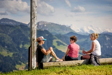
The hike over the Beichlengfähl into the Hilfern valley offers magnificent views. The detour on the high path to the Beichlen cross "Bösärni" is definitely worth it. You will be rewarded with a fantastic panoramic view. Not only the surrounding mountain world including the Bernese Alps can be seen from here, but also a view as far as the Jura range or Feldberg (D). The ascent involves some altitude, but nature compensates, for example with a fantastic variety of plants or shady forests. After the summit visit, the descent follows via Hilfern pass through swampy moorlands to Flühli.
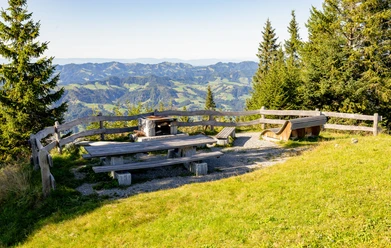
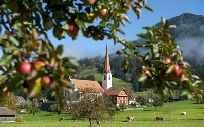
You start the hiking route at Escholzmatt station, which you leave heading south (Hutten-Beichlengfähl hiking trail). After the Alpach farm, the path is marked as a mountain hiking trail. After a short ascent, you reach the Hutten hill ridge and already have a nice view of the mountain world. Through fields and forest, you continue along the marked path to the Beichlengfähl. Here you turn left onto the forest road. After about 100 m you will be rewarded with a magnificent view of the Alps and as far as the Black Forest. There is also a nice barbecue area for a lunch break. The detour on the high path to the Beichlen cross opens up an amazing panoramic view. After the summit visit, you walk a short distance back on the same hiking path. At the first fork, take the hiking path toward Flühli and hike via Ober Schwarzeberg and Bärfalle toward Hilfern pass. Here you go through swampy moorlands, depending on the season lined with purple orchids or white cotton grass down to Flühli.
Experience the Hilfern valley in two days
Take your time and enjoy the peace and deceleration in the Hilfern valley over two days. The Schrattenblick Naturfreundehaus is beautifully nestled in the Hilfern valley, just a few minutes' walk from the descent route. You can even have breakfast and a simple dinner with Älplermagronen delivered and thus do not need to "carry" provisions. Information directly from the Schrattenblick Naturfreundehaus.

Waypoints
Good to know
Pavements
Best to visit
Equipment
Good shoes, a rain jacket & enough drinking water for the way belong to every hike.
More tips for safe hiking, information about cow-calf herds and livestock guardian dogs, and much more can be found on the website of the Swiss Hiking Paths.
Directions & Parking facilities
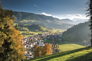
The UNESCO Biosphere Entlebuch is located in the heart of Switzerland, centrally between Bern and Lucerne. You can reach Escholzmatt via the main road 10 from Lucerne or Bern.
Plan your route using the Google route planner.
A paid parking lot is available at Escholzmatt station.
You can reach Escholzmatt by public transport via the Bern-Lucerne railway line. For the return journey, take the post bus from Flühli "Post" to Schüpfheim, from where you can again return to your starting point via the Bern-Lucerne railway line.
Plan your trip with the SBB online timetable.
Additional information
Escholzmatt-Marbach Tourism
Escholzmatt Tourism Info
Bahnhofstrasse 16
CH-6182 Escholzmatt
Phone +41 (0)41 486 01 30
www.escholzmatt-marbach-tourismus.ch
Author
Escholzmatt-Marbach Tourismus
Organization
UNESCO Biosphäre Entlebuch
License (master data)
Escholzmatt-Marbach Tourismus

Author´s Tip / Recommendation of the author
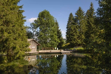
Your tired feet will also thank you for the short detour to the beautiful Kneipp facility Schwandalpweiher in Flühli.
Nearby


