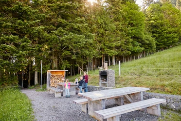
Sledding route near Heiligkreuz

- 0:35 h
- 1.66 km
- 172 m
- 1,126 m
- 1,298 m
- 172 m
- Start: Heiligkreuz
- Destination: Heiligkreuz
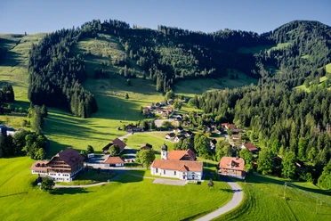
After a 1.7 km walk, you reach Alp Reistegg on the hiking and sledding route. The view of the valley and the opposite Napf mountain is a delight.
As a reward for the just under 45-minute ascent, a fast downhill ride awaits. As a crowning conclusion, you can recharge with a hot chocolate at the Kurhaus hotel.
Waypoints
Good to know
Pavements
- Street (100%)
Best to visit
- suitableDepends on weather
Directions
- From the large parking lot at the ski lift valley station via winter hiking trail / sledding slope to Reistegg.
Tour information
Familiy-Friendly
Refreshment stop
Directions & Parking facilities
- Getting there
The UNESCO Entlebuch Biosphere lies in the heart of Switzerland, centrally located between Bern and Lucerne. You can reach Heiligkreuz via main road 10 from Hasle or Schüpfheim.
Plan your route with the help of the Google route planner.
ParkingSeveral free parking spaces are available in Heiligkreuz.Public transportationYou can reach Heiligkreuz by post bus. The post bus stop «Heiligkreuz» is located directly next to the pilgrimage church and the Kurhaus Heiligkreuz hotel.
Plan your trip with the SBB online timetable.
Additional information
UNESCO Entlebuch Biosphere
Biosphere Centre
Chlosterbüel 28
CH-6170 Schüpfheim
Tel. +41 (0)41 485 88 50
www.biosphaere.chAuthor
UNESCO Biosphäre Entlebuch
Organization
UNESCO Biosphäre Entlebuch
License (master data)
UNESCO Biosphäre Entlebuch

Safety guidelines
- Please note that the path to Reistegg is not a dedicated sledding path but is also used as a winter hiking trail.