Bretzeli Photo Orienteering on Marbachegg


- 0:45 h
- 2.06 km
- 100 m
- 99 m
- 1,384 m
- 1,483 m
- 99 m
- Start: Mountain station Marbachegg
- Destination: Mountain station Marbachegg
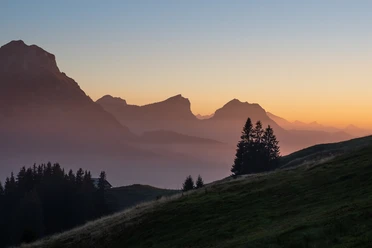
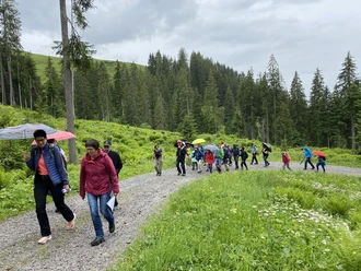
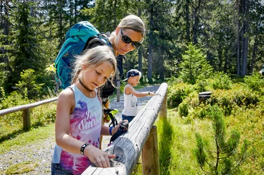
Who doesn't know the round Bretzeli from Kambly in Trubschachen! The fine cookies are also part of the Bretzeli Photo Orienteering on Marbachegg. Equipped with the orienteering map, which is available at the mountain station, you set out to find the photo posts on sunny Marbachegg. Along the way, you learn exciting facts about recreational offers on Marbachegg as well as about the Kambly Bretzeli.
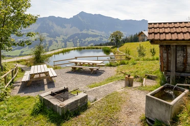
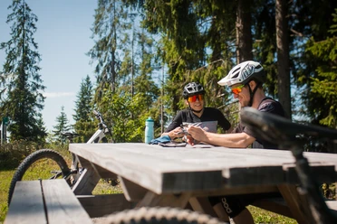
The photo orienteering first leads down to the little lake, where there is surely a post to photograph. If you like, you can take a break here, because at Speichersee there is also a great fire and picnic spot. Then it goes on towards Gassenegg. Keep your eyes open here, because in summer funny marmots frolic around here. With some luck and patience, you can hear and see them. From here, you follow the path through cozy forests back to Marbachegg. Those who have found all 10 posts and stamped the orienteering map correctly will receive a small surprise at the mountain or valley station at the end.
The time required for the photo orienteering is about 60–90 minutes. The Bretzeli Photo Orienteering is not stroller-friendly.
Opening hours
The Bretzeli Photo Orienteering on Marbachegg is accessible during the summer season operation of the Marbachegg sports lifts.
Prices
The circuit is free of charge. For the gondola lift a ticket must be purchased.
Equipment
The orienteering maps are available free of charge at the valley or mountain station.
Waypoints
Good to know
Best to visit
Directions
Tour information
Loop Road
Stop at an Inn
Equipment
Good footwear, rain jacket & enough drinking water for the journey are essential for every hike.
Further tips for safe hiking, information about cow-calf herds and guard dogs, and much more can be found on the website of Swiss Hiking Trails.
Directions & Parking facilities
The UNESCO Biosphere Entlebuch lies in the heart of Switzerland, centrally located between Bern and Lucerne. You can reach Marbach via main road 10 towards Wiggen. From Thun, you can reach Marbach via the Schallenberg.
Plan your route using the Google Route Planner.
You can reach Marbach by public transport via Escholzmatt (Bern-Lucerne railway line). From Escholzmatt, take the postal bus to Marbach "Valley Station Marbachegg".
Plan your trip with the SBB Online Timetable.
Additional information
Sportbahnen Marbachegg AG
Dorfstrasse 61
CH-6196 Marbach LU
Phone +41 (0)34 493 33 88
www.marbachegg.ch
Author
Escholzmatt-Marbach Tourismus
Organization
UNESCO Biosphäre Entlebuch
License (master data)
Escholzmatt-Marbach Tourismus

Author´s Tip / Recommendation of the author
Along the path, there are two beautiful fire pits - so plan enough time for a picnic!
Nearby


Download GPX file