Circular route Escholzmatt – Turner


- 3:30 h
- 10.81 km
- 431 m
- 431 m
- 853 m
- 1,252 m
- 399 m
- Start: Village square, Escholzmatt
- Destination: Village square, Escholzmatt
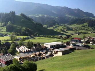
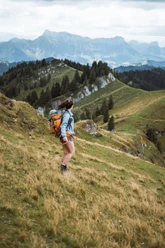
The hiking route starts in the village of Escholzmatt. Passing the imposing church in the middle of the village, the path leads towards Schwendelberg at the outskirts of the village. Here begins the ascent through the forest up to Schwendelberg. After a short section over pastureland, you reach the ridge and the small chapel of St. Anna. Plan a short break here - the view is fantastic with a look down into the village and to the local mountain Beichlen on the opposite side. There is also a nice picnic spot with a fireplace here.
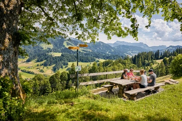
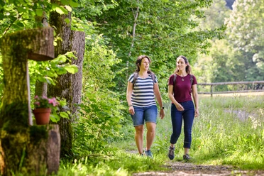
From here the path mostly runs on asphalted road, along the southwestern slopes of the Lombach valley via Obermatt to Bödeli. At the Mittelbödeli farm, the ascent continues via Oberbödeli. Markings and trail posts lead over the meadow slope up to the Turner, which is adorned with magnificent trees. Here you are rewarded with an impressive panoramic view - the highest summit destination is now also within sight. It’s not far to the Bock now, ideal for a lunch break with fine views before you start the second, shorter section of the circular hike. The trail leads through the Bock forest to Bärgli. Towards Lochweidli and then Lochgut you walk down the valley incision and back to Escholzmatt via Grabenhof.

Waypoints
Good to know
Pavements
Best to visit
Directions
Escholzmatt, village square - St. Anna - Obermatt - Bödeli - Mittelbödeli - Oberbödeli - Höch - Turner - Bock - Bärgli - Escholzmatt, village square
Tour information
Loop Road
Equipment
Good footwear, a rain jacket & enough drinking water for the trip are part of every hike.
More tips for safe hiking, information about suckler cow herds and guardian dogs, and much more can be found on the website of the Swiss Hiking Trails.
Directions & Parking facilities
The UNESCO Biosphere Entlebuch lies in the heart of Switzerland, centrally located between Bern and Lucerne. You can reach Escholzmatt via main road 10.
Plan your route with the help of the Google route planner.
A paid parking lot is available at Escholzmatt railway station.
You can reach Escholzmatt by public transport via the Bern-Lucerne train line.
Plan your journey with the SBB online timetable.
Additional information
Escholzmatt-Marbach Tourism
Tourism Info Escholzmatt
Bahnhofstrasse 16
6182 Escholzmatt
Tel. +41 (0)41 486 01 30
www.escholzmatt-marbach-tourismus.ch
Author
Escholzmatt-Marbach Tourismus
Organization
UNESCO Biosphäre Entlebuch
License (master data)
Escholzmatt-Marbach Tourismus

Author´s Tip / Recommendation of the author
The short detour to the Bock is rewarded with a great view. At the starting point, you can stock up on fine regional delicacies at the Biosphere shop.
Nearby


Download GPX file