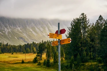
Moorland Landscape Trail UNESCO Entlebuch Biosphere


- 27:15 h
- 79.17 km
- 4,054 m
- 4,054 m
- 882 m
- 1,806 m
- 924 m
- Start: Sörenberg, Sörenberg PostBus stop, Post
- Destination: Sörenberg, Sörenberg PostBus stop, Post
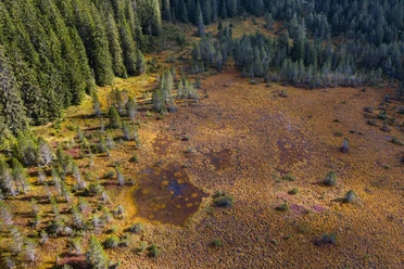
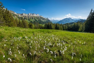
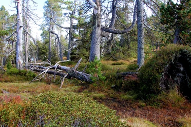
Hardly any other region of Switzerland possesses as many natural treasures as the "Wild West" of Lucerne. Here you find the largest and most numerous moor landscapes of Switzerland and a fauna and flora of (inter)national importance. No wonder Entlebuch was designated by UNESCO as the first biosphere reserve in Switzerland. Over 400 square kilometers stretches a mystical world promising peace, inspiration, and relaxation. The over 80 km long Moorland Landscape Trail leads in five stages to the mystical moors and offers extraordinary experiences: rugged Schrattenfels and gentle moor landscapes, deep trenches and gorges from the Ice Age, steep limestone cliffs of the Schwändelifluh, or primeval mountain pine moors and romantic mountain lakes.
Package offer
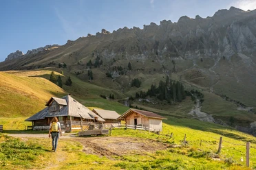
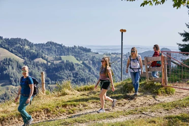
While you hike on the signposted Moorland Landscape Trail, enjoy the fascinating natural landscapes and eat the provided lunch at the most beautiful spots, your luggage travels to the next overnight location. Here, too, you enjoy a great variety – from sleeping in a tipi on the alp to a 3*-hotel with a regional 4-course menu – and fall into a deep, restful sleep. Here is the package offer
Stage 1: Moorland Landscape Habkern / Sörenberg Sörenberg to Kemmeribodenbad
Stage 2: Moorland Landscape Hilferepass Kemmeribodenbad to Flühli
Stage 3: Moorland Landscape Klein Entle Flühli to Gfelle (Finsterwald / Entlebuch)
Stage 4: Moorland Landscape Glaubenberg Gfelle (Finsterwald / Entlebuch) to Stäldili (Flühli)
Stage 5: Moorland Landscape Glaubenberg Stäldili (Flühli) to Sörenberg
Recommended reading: Nina takes you on the Moorland Landscape Trail in her report.
Waypoints
Good to know
Best to visit
Directions
Tour information
Loop Road
Nature Highlight
Equipment
Directions & Parking facilities
The UNESCO Entlebuch Biosphere is located in the heart of Switzerland, centrally between Bern and Lucerne. By car, you can reach the various stages via main road 10.
Plan your route using the Google Route Planner.
At the starting points there are various free and paid parking spaces.
You can reach the various stages by public transport via the Bern-Lucerne railway line.
Plan your trip with the SBB Online Timetable.
Additional information
UNESCO Entlebuch Biosphere
c/o Biosphere Centre
Chlosterbüel 28
CH-6170 Schüpfheim
Telephone +41 (0)41 485 88 50
www.biosphaere.ch
Literature
The brochure "Moorland Landscape Trail" is available at the Biosphere Centre or can be ordered here.
Author
UNESCO Biosphäre Entlebuch
Organization
UNESCO Biosphäre Entlebuch
License (master data)
UNESCO Biosphäre Entlebuch

Author´s Tip / Recommendation of the author
Safety guidelines
Partly poor or no mobile reception. The hikes are rated according to the six-level SAC hiking scale with T2 = mountain hiking "white-red-white marking, terrain partly steep, risk of falling not excluded". Good fitness is advantageous for the rather long and strenuous day hikes on the Moorland Landscape Trail.
Important info:
In the Glaubenberg/Wasserfallen area there are various Swiss Army shooting ranges. Detailed information and shooting dates can be found here. Entering the danger area is life-threatening and therefore prohibited. The instructions of the barrier posts must be followed.
Our recommendations
Nearby


Download GPX file