Entlebuch Emmental high route


- 13:31 h
- 41.84 km
- 1,652 m
- 1,473 m
- 729 m
- 1,415 m
- 686 m
- Start: Doppleschwand, PostBus stop Doppleschwand, Post
- Destination: Schangnau, PostBus stop Schangnau, Post
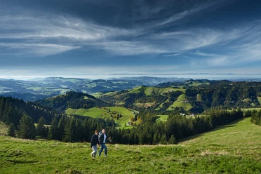
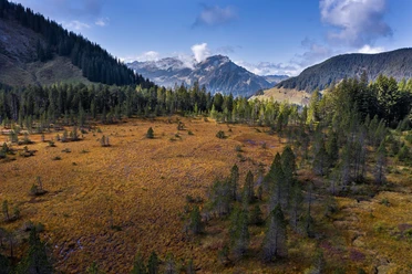
Sometimes the view looks towards the wild ravines and creeks of the Napf area. Sometimes it goes down into the lovely main valley of Entlebuch, onto streets and villages. And further on to the otherworldly hills and up to the eternal snow of the Bernese Alps. Start at dawn when the dew glitters and enjoy a unique fauna and flora. Rest in cozy inns far from noise and hustle and enjoy fascinating views.
The Entlebuch Emmental high route is divided into several stages and runs entirely on the existing hiking trail network. So you can set off without worries and according to your fitness. The lowest point is at 731 meters above sea level, the highest at 1415 meters above sea level – therefore the route is also feasible in spring and autumn when there may still be snow at higher altitudes. The entire trail is marked with high route signposts.
Stage 1: Doppleschwand – Obstaldenegg
Stage 2: Obstaldenegg – Turner
Stage 3: Turner – Trubschachen
Waypoints
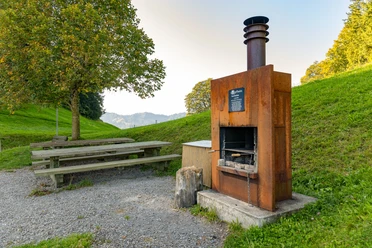
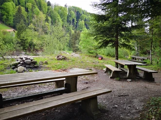
Good to know
Pavements
Best to visit
Directions
Stage 1: Doppleschwand – Obstaldenegg
Doppleschwand Post – Weghus – Chrüzbüel – Oberhüseren Chapel – March – Chriesbaumen – Bergli – (> descent to Hasle) – Hohmättili – Voglisbergegg – Schüpferegg – Obstaldenegg > descent to Schüpfheim
Stage 2: Obstaldenegg – Turner
Obstaldenegg – Gmeinwerch – Mittlisthütte – Champechnubel – Stutzegg – Chrüzbode – Grätliegg – Altegrat – Turner > descent to Escholzmatt
Stage 3: Turner – Trubschachen
Turner – Nageldach – Ober-Altgäfäl – Hinter Risisegg – Schindelegg (> descent to Trub) – Mittler Risisegg – Alpetli – Lower Schwand – Trubschachen
Stage 4: Trubschachen – Grosshorben
Trubschachen – Bärgenhüsi – Houenenegg – Lower Houenen – Upper Houenen – Chäserenegg – Rämisgummen – Behind Rämisgummen – Pfyffer – Grosshorben
Stage 5: Grosshorben – Schangnau
Grosshorben – Bergegg – Wachthubel (> descent to Marbach) – Oberi Flue – Meisenegg – Rütiboden – Upper Rüti – Lower Lamm – Vord. Scheidbach – Lower Rüti – Schangnau
Ascent and descent possibilities from the Entlebuch Emmental high route
- Entlebuch station - Habschwanden: ascent 45 minutes, descent 35 minutes
- Hasle station - Bergli: ascent 35 minutes, descent 25 minutes
- Schüpfheim station - Obstaldenegg: ascent 1 hour 25 minutes, descent 1 hour 10 minutes
- Escholzmatt station - Turner: ascent 1 hour 35 minutes, descent 1 hour 15 minutes
- Landgasthof Sternen Trub - Schindelegg: ascent 1 hour 40 minutes, descent 1 hour 40 minutes
- Egghus Wiggen - Grosshorben: ascent 2 hours, descent 1 hour 40 minutes
- Post Marbach - Wachthubel: ascent 2 hours, descent 1 hour 25 minutes
Equipment
Good footwear, a rain jacket, and enough drinking water for the journey are essential for every hike.
Further tips for safe hiking, information on suckler cow herds and livestock guardian dogs, and much more can be found on the Swiss Hiking Trails website.
Directions & Parking facilities
The UNESCO Biosphere Entlebuch lies in the heart of Switzerland, centrally located between Bern and Lucerne. By car, you can reach the various stages via main road 10.
Plan your route with the help of the Google route planner.
At the starting points, there are various free and paid parking spaces.
You can reach the various stages by public transport via the Bern-Lucerne railway line.
Plan your trip with the SBB online timetable.
Additional information
UNESCO Biosphere Entlebuch
c/o Biosphere Center
Chlosterbüel 28
CH-6170 Schüpfheim
Phone +41 (0)41 485 42 50
www.biosphaere.ch
Author
UNESCO Biosphäre Entlebuch
Organization
UNESCO Biosphäre Entlebuch
License (master data)
UNESCO Biosphäre Entlebuch

Our recommendations


Nearby


