Mountain hike over the Risete


- 4:15 h
- 9.45 km
- 827 m
- 827 m
- 1,007 m
- 1,827 m
- 820 m
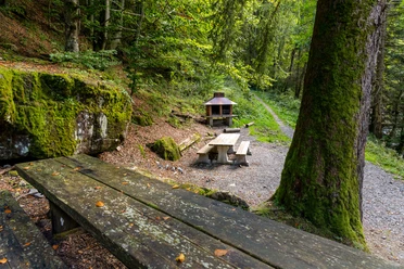
- Start: Restaurant Gfellen
- Destination: Restaurant Gfellen
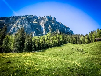
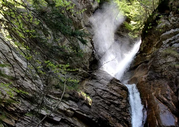
The mountain path is consistently marked with white-red-white markings. The hiking route starts at the Restaurant Gfellen and leads moderately along the Riesete forest to Alp Risete - the ancient hut under heritage protection is a feast for the eyes. Then follows the sweaty ascent to Blaue Tosse, where in addition to a wonderful panoramic view of the Glarus Alps, Titlis, Eiger, Mönch, Jungfrau, Fribourg Alps, Jura, and some Mittelland lakes, a summit cross also awaits. Treat yourself to a rest and sign the summit register. Chamois and ibex are often seen in the Risete mountain range. The flora is also extremely diverse. The small raised bog with the dwarf pines below the cross is impressive, as is the section on the south side with the bright limestone rocks. Enjoy this fantastic mountain landscape in peace before you start the descent.
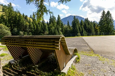
At Alpeli (signpost) there is a shelter with a rest area inviting for a lunch break. The remaining descent first proceeds somewhat steeper through the forest, later more moderately back to Restaurant Gfellen.

Good to know
Pavements
Best to visit
Directions
Gfellen – Gfelleschilt - Ristetealp – Blaue Tosse – Älpeli – Mittlisthütte – Hintergfellen - Gfellen
Undertake the hike following the described route (clockwise).
Tour information
Loop Road
Mountain Railway Tour
Summit
Equipment
Good footwear, rain jacket & sufficient drinking water for the way are essential for every hike.
Further tips for safe hiking, information on suckler cow herds and livestock guardian dogs, and much more can be found on the Swiss Hiking Trails website.
Directions & Parking facilities
The UNESCO Biosphere Entlebuch lies in the heart of Switzerland, centrally located between Bern and Lucerne. You can reach Gfellen via the main road 10 towards Entlebuch and from there to Gfellen (direction Glaubenberg). From Sarnen, you drive over the Glaubenberg to Gfellen.
Plan your route with the help of the Google Route Planner.
A paid parking lot is available at the Restaurant Gfellen.
You can reach Gfellen by public transport via Entlebuch (Bern-Lucerne railway line). From Entlebuch, take the post bus to Gfellen.
Plan your trip with the SBB Online Timetable.
Additional information
Literature
Author
UNESCO Biosphäre Entlebuch
Organization
UNESCO Biosphäre Entlebuch
License (master data)
UNESCO Biosphäre Entlebuch

Author´s Tip / Recommendation of the author
Plan enough time to enjoy the flora and fauna as well as the unique panoramic view from the summit.
Safety guidelines
Mountain hiking trail with partly steep sections, to be traversed very carefully under wet conditions, a few sections are secured with ropes and chains, large altitude difference.
Nearby

Download GPX file