1x Meringue and back


- 5:25 h
- 69.18 km
- 1,033 m
- 1,033 m
- 689 m
- 1,316 m
- 627 m
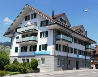
- Start: Hotel Drei Könige, Entlebuch
- Destination: Hotel Drei Könige, Entlebuch
The sweet route starts in the village of Entlebuch. From here, you ride leisurely along the Emme towards Hasle and Schüpfheim. Then the climb to Flühli begins. Take a short break in Flühli and visit one of the most beautiful Kneipp facilities in Switzerland. At Schwandalpweiher, your legs will be strengthened for the somewhat tougher section up to Sörenberg and Salwideli. The beautiful view of the impressive moorland and the distinctive Schrattenfluh quickly makes you forget the effort and richly rewards you with beautiful views. Along the Schrattenfluh, you continue towards Kemmeriboden. Do not miss the "Merängge" at the Kemmeriboden-Bad country inn. After the sweet refreshment, the route leads back over the border to Entlebuch via Marbach and Escholzmatt, returning to Schüpfheim, Hasle, and the starting point Entlebuch.
Waypoints

Good to know
Pavements
Best to visit
Directions
Entlebuch - Schüpfheim - Sörenberg - Kemmeriboden - Schangnau - Wiggen - Schüpfheim - Entlebuch
Tour information
Loop Road
Stop at an Inn
Equipment
Rent a Bike rental station:
Hotel Drei Könige
Dorf 27
6162 Entlebuch
FLYER reservation:
Tel: +41 41 921 05 75
or online at: www.rentabike.ch
Directions & Parking facilities
The UNESCO Entlebuch Biosphere lies in the heart of Switzerland, centrally located between Bern and Lucerne. You can reach Entlebuch via main road 10. From Sarnen, you drive over the Glaubenberg to Entlebuch.
Plan your route with the help of the Google route planner.
You can reach Entlebuch by public transport via the Bern-Lucerne railway line.
Plan your trip with the SBB online timetable.
Additional information
UNESCO Entlebuch Biosphere
Biosphere Center
Chlosterbüel 28
CH-6170 Schüpfheim
Tel. +41 (0)41 485 88 50
www.biosphaere.ch
Literature
The brochure "Cycling map Lucerne" with many interesting route suggestions in the UNESCO Entlebuch Biosphere and Lucerne region is available at: UNESCO Entlebuch Biosphere
Author
UNESCO Biosphäre Entlebuch
Organization
UNESCO Biosphäre Entlebuch
License (master data)
UNESCO Biosphäre Entlebuch

Author´s Tip / Recommendation of the author
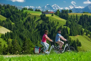
In the Salwideli area, you can enjoy a fantastic view of the Sörenberg-Habkern moorland and the Schrattenfluh!
Safety guidelines
- Unpaved section between Südelhöhe and Kemmeriboden-Bad, approx. 7 km.
- Currently, there is no battery change on the route and no charging devices are available from Entlebuch. Conservative use of the battery is highly recommended on this route.
Wear the correct protective gear, accurately assess your skill level, give priority to hikers, stay on the trail, and close pasture gates!
Refer to the Central Switzerland Bike Codex - so you are welcome on your mountain bike!
Nearby


Download GPX file