Emmenuferweg Stage 1: Brienzer Rothorn–Sörenberg


- 3:00 h
- 9.68 km
- 42 m
- 1,176 m
- 1,153 m
- 2,328 m
- 1,175 m
- Start: Sörenberg, Brienzer Rothorn
- Destination: Sörenberg, village
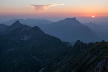
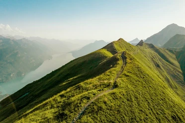
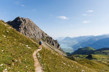
The hike begins with great views – on the highest peak of the canton of Lucerne, the Brienzer Rothorn. Once at the top, it is worth pausing for a moment and taking in the panorama. The view stretches north over the Waldemmental. In clear weather, the view extends over the Napf and the lakes beyond to the Black Forest. On the other side, Lake Brienz glistens in the depths, above which the snow-covered peaks of Eiger, Mönch, Jungfrau, and up to 690 other mountain peaks tower.
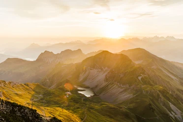
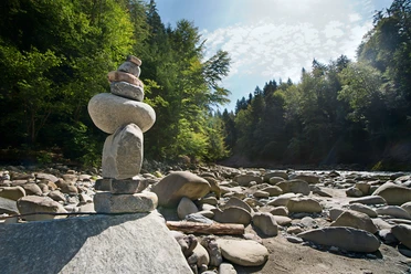
Past the viewpoint begins the descent towards Eisee. The small mountain lake lies at the foot of the Arnihaaggen, embedded in a mosaic of scree slopes and green meadows. The lakeshore invites for a first break. Those who dare can cool their feet in the icy cold mountain lake before tackling the descent towards Emmensprung. The path snakes further downhill in several switchbacks until the Emmensprung is reached at 1465 m altitude. As if from nowhere, the spring water bubbles out of the ground and finds its way into the valley, where it finally flows into the Waldemme. Just a few meters further, you will discover two waterfalls in the middle of a small forest, where water gushes down moss-covered rocks.
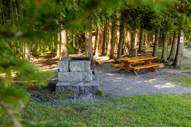
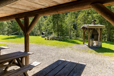
Over gentle meadows, the route follows the branched streams into the valley. On the descent, you immerse yourself in the UNESCO Entlebuch Biosphere with its unique river and moor landscapes, cozy floodplain forests, and scattered settlements. From the valley station of the aerial cableway, you can look forward to the comfortable part of the stage. Without major ascents or descents, the hiking trail leads along the Waldemme to the village of Sörenberg.

Good to know
Pavements
Best to visit
Directions
Brienzer Rothorn - Eisee - Emmensprung - Sörenberg (village)
The entire route is marked with the signposts «83 Emmenuferweg».
Equipment
Good footwear, a rain jacket, and enough drinking water for the journey are essential for every hike.
More tips for safe hiking, information about suckler cow herds and guardian dogs, and much more can be found on the website of Schweizer Wanderwege.
Directions & Parking facilities
The UNESCO Entlebuch Biosphere lies in the heart of Switzerland, centrally between Bern and Lucerne. You can reach Sörenberg via main road 10 towards Schüpfheim and from there to Flühli Sörenberg. From Giswil via the panoramic road / Glaubenbielenpass to Sörenberg.
Plan your route with the help of the Google route planner.
A paid parking lot is available at the valley station of the Sörenberg - Brienzer Rothorn aerial cableway.
You can reach Sörenberg by public transport via Schüpfheim (Bern-Lucerne railway line). From Schüpfheim take the Postbus to Sörenberg "Rothornbahn".
Plan your journey with the SBB online timetable.
Additional information
UNESCO Entlebuch Biosphere
Biosphere Centre
Chlosterbüel 28
CH-6170 Schüpfheim
Telephone +41 (0)41 485 42 50
www.biosphaere.ch
Author
UNESCO Biosphäre Entlebuch
Organization
UNESCO Biosphäre Entlebuch
License (master data)
UNESCO Biosphäre Entlebuch

Author´s Tip / Recommendation of the author
On the highest mountain in Lucerne you will find a large ibex colony. With some luck and patience, you can observe the proud kings of the mountains.
Safety guidelines
On high-altitude sections, snowfields are possible until the summer months.
Nearby