Energized through Entlebuch


- 2:55 h
- 36.70 km
- 855 m
- 855 m
- 519 m
- 1,021 m
- 502 m
- Start: Entlebuch
- Destination: Entlebuch
The route starts in the village of Entlebuch. Just outside the village, turn towards Rengg, from there it goes uphill until you reach Rengg. Once at the top, you will be rewarded with a great panoramic view of the hilly landscape of Entlebuch and the Lucerne hinterland. The mighty wind turbines are also clearly visible from here. With a magnificent view, you can admire the height and rotational power of the installations.
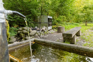
The municipality of Entlebuch is generally dedicated to the topic of energy, so you will repeatedly encounter interesting energy platforms on your tour. For example, also the moorland Mettilimoos, also near Rengg: thousands of tons of peat were cut during the two World Wars in Mettilimoos and at Wissenegg and burned in company ovens instead of coal. The equipment used is exhibited in the peat hut. Take off your shoes and socks – in our moor footbath you can convince yourself of the beneficial effects of the moor. Today the moors are protected by the way.
From Rengg, the route leads back down towards Schachen – Werthenstein and Wolhusen. In Wolhusen, there is another ascent towards Doppleschwand. From here, the tour takes you via Habschwanden and Hasle back to Entlebuch. Here you will find, for example, the two gastronomy partners of the Biosphere Entlebuch, the Bahnhöfli or the Hotel Drei Könige, where you can refuel with a delicious meal.
Waypoints
Good to know
Best to visit
Directions
Entlebuch - Rengg - Schachen - Werthenstein - Wolhusen - Doppleschwand - Habschwanden - Hasle - Entlebuch
The route follows the national and regional Veloland routes from SchweizMobil: R73 Entlebuch – Rengg – Schachen – Werthenstein – Wolhusen, R24 Wolhusen – Doppleschwand – Hasle – Entlebuch
Tour information
Loop Road
Nature Highlight
Stop at an Inn
Equipment
Good equipment including rain and warm protection and wearing a helmet is of course essential. Repair and first aid kits are always with you. Your bike is roadworthy and you have lights for dusk.
For this route, a spare battery might also be recommended.
Directions & Parking facilities
The UNESCO Biosphere Entlebuch lies in the heart of Switzerland, centrally between Bern and Lucerne. You reach Entlebuch via main road 10. From Sarnen, you drive over Glaubenberg to Entlebuch.
Plan your route with the help of the Google route planner.
You can reach Entlebuch by public transport via the Bern-Lucerne railway line.
Plan your journey with the SBB Online timetable.
Additional information
UNESCO Biosphere Entlebuch
c/o Biosphere Center
Chlosterbüel 28
6170 Schüpfheim
Phone +41 (0)41 485 88 50
www.biosphaere.ch
Literature
The brochures «Bike Guide» and «Velokarte Lucerne» are available at the Biosphere Center or in the brochure shop at www.biosphaere.ch
Author
UNESCO Biosphäre Entlebuch
Organization
UNESCO Biosphäre Entlebuch
License (master data)
UNESCO Biosphäre Entlebuch

Author´s Tip / Recommendation of the author
Plan time to discover the various platforms on the Erlebnis Energie Entlebuch theme trail!
Safety guidelines
Partially unpaved section (approx. 7 km between Rengg and Schachen).
Wear the correct protective gear, assess your abilities correctly, give way to hikers, stay on the trail and close pasture fences!
Orient yourself by the Central Switzerland Bike Code – this way you will be welcome on your mountain bike!
Nearby


Download GPX file