Herzschlaufe Napf | 399 Langnau - Entlebuch


- 3:40 h
- 43.75 km
- 1,100 m
- 1,080 m
- 673 m
- 1,210 m
- 537 m
- Start: Rental station Entlebuch or Langnau
- Destination: Rental station Langnau or Entlebuch
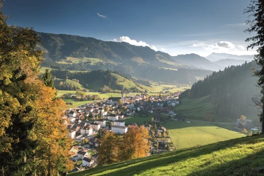
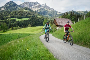
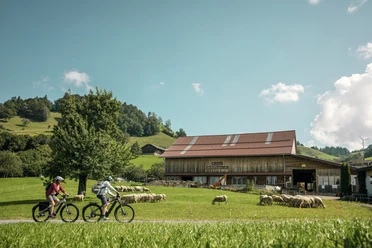
This stage deals with the south side of the Napf and its wonderful sun-tanned slopes. From Langnau, we leisurely follow the Ilfis and soon reach Trubschachen, the sturdy Emmental village with the enticing scent of baked goods in the air. Having escaped the local biscuit paradise, we climb a lonely valley landscape that leads us higher and higher into the hills until the border mountain 'Turner' marking the transition to the Lucerne Entlebuch. Here, at 1200 meters, the panorama of the valley opens up along with the rocky arena of the mountains grouped behind it. It's a feeling of 99 curves down to Escholzmatt, which swiftly carries us downhill. From now on we enjoy the most beautiful heights through the UNESCO biosphere reserve and its scenic gems. Deep ravines open beneath us, and the mighty shoulders of the Napf carry us safely to the village of Entlebuch, where a well-deserved afternoon snack awaits us.
Good to know
Pavements
Best to visit
Tour information
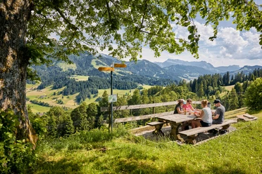
Stop at an Inn
Equipment
E-bike reservation recommended via rentabike.ch
Directions & Parking facilities
Additional information
The route is marked in both directions as Route 399 "Herzschlaufe Napf". Only between Langnau and Trubschachen do you follow Route 24. Want to take a look at the Herzroute website? herzroute.ch
Note: Between SchweizMobil & Outdooractive, there can be significant discrepancies in the elevation information. This is based on differently resolved terrain models, with SchweizMobil already accounting for small differences.
Author
Herzroute AG
Organization
Erlebnismacher AG - #wirsindofflinehelden
Author´s Tip / Recommendation of the author
The famous Kambly factory is located in Trubschachen. Enjoy the distinctive Kambly cookies during a break.
Nearby

