Herzschlaufe Napf | 399 Entlebuch - Willisau


- 4:59 h
- 53.93 km
- 1,550 m
- 1,680 m
- 555 m
- 1,104 m
- 549 m
- Start: Rental station Entlebuch or Willisau
- Destination: Rental station Willisau or Entlebuch
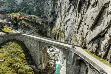
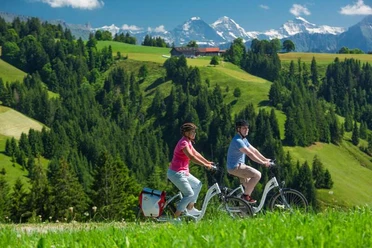
Starting from the tranquil village of Entlebuch, the route soon winds into the wild labyrinth of ridges and ditches. In Romoos you still enjoy pre-alpine hospitality, then follow endless sections where you travel alone with the landscape, a few farms, and plenty of views. Suddenly the route drops steeply to find itself in the small Fontanne, a ditch with a Wild West flair. In this gorge, you meet gold prospectors, mushroom collectors, and fearless Herzschlaufe guests who grill a sausage in the stream bed. The ascent to Menzberg requires quite a bit of strength but is rewarded with a new altitude experience, this time close enough to touch the main Napf ridge, which you never actually reach. This hilly terrain with its hundred ditches is too tangled. One such ditch swallows us up again after a roaring descent and leads us uphill once more, this time to the heights of the Luthertal, which gently guides us towards Willisau.
Good to know
Pavements
Best to visit
Tour information
Stop at an Inn
Equipment
Reservation of e-bike recommended via rentabike.ch
Directions & Parking facilities
Additional information
The route is signposted in both directions as Route 399 «Herzschlaufe Napf». Want to take a look at the Herzroute website? herzroute.ch
Note: There can be significant differences in altitude information between SchweizMobil & Outdooractive. This is based on differently resolved terrain models, with SchweizMobil already including small differences.
Author
Herzroute AG
Organization
Erlebnismacher AG - #wirsindofflinehelden
Author´s Tip / Recommendation of the author
Nearby
