Hirsegg - Schrattenfluh - Rossweid - Sörenberg


- 6:37 h
- 17.96 km
- 1,195 m
- 1,112 m
- 1,070 m
- 2,058 m
- 988 m
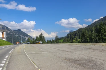
- Start: Bus stop Sörenberg, Hirsegg
- Destination: Village center Sörenberg
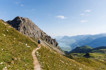
The Schrattenfluh, the most obvious karst mountain range in the biosphere, is part of the strictly protected core zone and one of the most pristine karst landscapes in Switzerland. From a distance, it appears practically vegetation-free and is actually only sparsely vegetated. The Schrattenfluh impresses not only above ground with bizarre patterns in the karst rock but also underground with its extensive cave system. Yet, some pretty cushion plants and alpine roses, which the people of Entlebuch also call «Steirösli», grow on the Schrattenfluh. On the northern side, there are steep, rugged rock walls with large scree fields that then transition into alpine meadows and moor areas. Thanks to this variety of different habitats, it features a great diversity of animal and plant species.
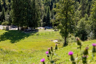
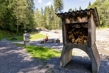
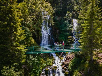
The day hike leads from Hirsegg to Alp Schlund and from there over the fascinating karst fields of the Schrattenfluh to the ridge and towards "Türstehäuptli" and "Schibengütsch", where you can enjoy a fantastic panoramic view of the Brienzer Rothorn chain, the Bernese Alps, the Hilfern valley, the Hohgant, and many other mountains and landscapes. On the descent, you walk past Böli on the right; at the foot lies the SAC hut Chlus. Overnight stays are possible here, but the hut is not staffed. Shortly before Alp Schneeberg, you will find a nice barbecue area directly on the Bärselbach if you want to take a break. And be sure to stop at the farm shop of Alp Schneeberg. The fine homemade jams, syrups, and pear bread invite you to snack. The path then leads you towards the mountain inn Salwideli through the beautiful moorland towards Rossweid. The hiking trail then leads uphill through the forest into the village of Sörenberg. From Rossweid, you also have the option to return to the village of Sörenberg by gondola lift.

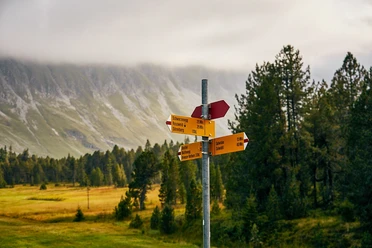
Waypoints
Good to know
Pavements
Best to visit
Directions
Hirsegg - Stächelegg - Schlund - Matte - Türstehäuptli - Schiebengütsch - Under Imbärgli - Schneeberg - Salwideli - Rossweid - Sörenberg
Tour information
Nature Highlight
Equipment
Good footwear, rain jacket & enough drinking water are part of every hike.
More tips for safe hiking, information on suckler cow herds and guardian dogs and much more can be found on the Swiss Hiking Federation website.
Directions & Parking facilities
The UNESCO Biosphere Entlebuch is located in the heart of Switzerland, centrally between Bern and Lucerne. You can reach Sörenberg via main road 10 towards Schüpfheim and from there to Flühli Sörenberg. From Giswil via the panoramic road / Glaubenbielenpass to Sörenberg.
Plan your route using the Google route planner.
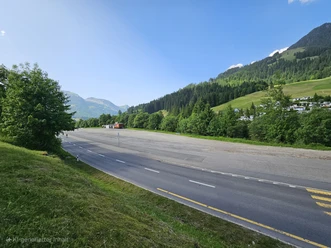
A paid parking lot is available at Hirsegg.
By public transport, you can reach Sörenberg via Schüpfheim (Bern-Lucerne train line). From Schüpfheim, take the postal bus to Sörenberg "Hirsegg".
Plan your trip with the SBB Online Timetable.
Additional information
Sörenberg Flühli Tourism
Rothornstrasse 21
CH-6174 Sörenberg
Phone +41 (0)41 488 11 85
www.soerenberg.ch
Literature
Author
UNESCO Biosphäre Entlebuch
Organization
UNESCO Biosphäre Entlebuch
License (master data)
UNESCO Biosphäre Entlebuch

Author´s Tip / Recommendation of the author
A detour to the highest point on the Schrattenfluh, the "Hängst", is worthwhile!
Safety guidelines
Information on the current condition of the Sörenberg-Flühli hiking trail network is updated daily on the panorama hiking map.
The hike requires surefootedness. The sharp-edged Schrattenfels should not be underestimated.
Map
Official map of the Swiss hiking trails 1:33,333 «Napf-Sörenberg», ISBN number 978-3-302-33321-2
Nearby


