Glaubenbielen - Haglere - Sörenberg


- 3:35 h
- 9.78 km
- 485 m
- 903 m
- 1,151 m
- 1,948 m
- 797 m
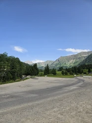
- Start: Glaubenbielen Parking Lot
- Destination: Sörenberg
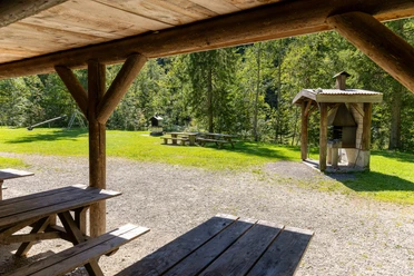
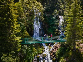
The hike starts at the parking lot on the Glaubenbielenplatz. Need provisions for the hiking route? At the entry to the hiking trail, there is a small alpine kiosk with fine cheese. After a short time, you also pass the Glaubenbielen alpine farm, in case you need a coffee or a small refreshment for the first ascent; after that, there are no more restaurants on this route.
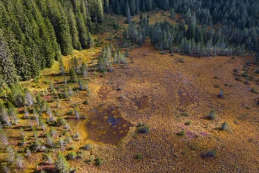
Soon the tougher part of the route begins, and the ascent towards Rotspitz starts. The fantastic view of the Brienzer Rothorn and the Schrattenfluh on one side and the Pilatus, Stanserhorn, and Rigi on the other side accompany you for a long time on this route. You then climb Nünalpstock and finally Haglere at 1948 m above sea level. At the summit cross, a break is well deserved. Watch out for dead trunk and root remains of mountain pines along the way. Perhaps a lizard is sunbathing there? Moor lizards are typical inhabitants of moor areas - Haglere is a nature reserve of Pro Natura. Did you know that well over a quarter of the UNESCO Biosphere Entlebuch area is covered with moorlands of national importance? Nowhere in Switzerland are there as many nationally protected moors in such a small area as in Entlebuch: 44 raised bogs, 61 low bogs, and 4 large moor landscapes shape our landscape.
For the descent towards Alpweid and Sörenberg, some leg strength is still required. The path first goes through the extensive terrain with a great view before you branch left onto the hiking trail towards Alpweid. After a short forest section, the hiking trail runs at times over open pastures. Take your time to admire the biodiversity along the path. At Alpweid, you switch from the hiking trail to the paved road and walk down into the village of Sörenberg.

Good to know
Pavements
Best to visit
Directions
Glaubenbielen Parking Lot - Rotspitz - Nünalpstock - Teufimattsattel - Haglere - Alpweid - Sörenberg
Tour information
Nature Highlight
Stop at an Inn
Equipment
Good footwear, rain jacket & sufficient drinking water for the hike belong to every hike.
Further tips for safe hiking, information on cow-calf herds and guardian dogs, and much more can be found on the website of the Swiss Hiking Trails.
Directions & Parking facilities
The UNESCO Biosphere Entlebuch lies in the heart of Switzerland, centrally between Bern and Lucerne. You reach Sörenberg via main road 10 towards Schüpfheim and from there to Flühli Sörenberg. From Giswil via the panoramic road / Glaubenbielen Pass to the pass height / parking lot.
Plan your route using the Google route planner.
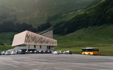
A free parking lot is available at the Glaubenbielen Pass height.
You can reach Sörenberg by public transport via Schüpfheim (Bern-Lucerne railway line). From Schüpfheim take the postbus to Sörenberg "Glaubenbielen, Parking Lot". Attention, there are only a few connections per day from Sörenberg to the Glaubenbielen Pass!
Plan your trip with the SBB Online Timetable.
Additional information
Sörenberg Flühli Tourism
Rothornstrasse 21
CH-6174 Sörenberg
Phone +41 (0)41 488 11 85
www.soerenberg.ch
Author
Sörenberg Flühli Tourismus
Organization
UNESCO Biosphäre Entlebuch
License (master data)
Sörenberg Flühli Tourismus

Author´s Tip / Recommendation of the author
The hike is especially beautiful in autumn due to the colorful moor landscape and clear long-distance views.
Safety guidelines
Information on the current condition of the Sörenberg-Flühli hiking trail network can be found daily on the panorama hiking map.
Map
Official map of the Swiss Hiking Trails 1:33,333 «Napf-Sörenberg», ISBN number 978-3-302-33321-2
The brochure «Hiking» with many interesting hiking suggestions is available at Sörenberg Flühli Tourism or in the brochure shop at www.soereneberg.ch
Nearby


