Sörenberg - Satz - Haglere - Mittlist Gfäl - Sörenberg


- 4:15 h
- 9.25 km
- 791 m
- 793 m
- 1,156 m
- 1,948 m
- 792 m
- Start: Village center Sörenberg
- Destination: Village center Sörenberg
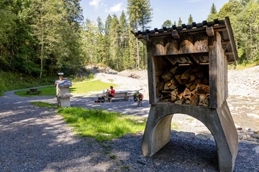
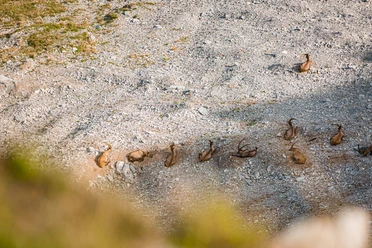
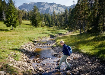
The start and finish of this demanding hiking route is in the village of Sörenberg. Through the Obersörenberg district, you hike uphill towards Alpweid. From here, you increasingly immerse yourself in the natural landscape. Juicy alpine meadows and shading forests. At the Teufimattsattel, take the branch towards Haglere. From there, you can admire the colorful moorland of the Haglere area. The nature reserve promises pure nature. Look and listen around, many animal species, moor plants, and gnarled mountain pines can be found here.
At the summit cross, almost 2,000 m above sea level, you can enjoy a fantastic view - over the village of Sörenberg but also of the surrounding mountain scenery.
Now the descent begins again. Enjoy the diverse moorland once more on the first section of the trail. In the Mittlistgfäl area, take the hiking trail back to Sörenberg. Here, you will need to use your legs again. You hike back towards Alpweid and from there back to the village.

Waypoints
Good to know
Pavements
Best to visit
Tour information
Loop Road
Nature Highlight
Summit
Equipment
Good footwear, a rain jacket & enough drinking water for the journey are part of every hike.
More tips for safe hiking, information about suckler cow herds and livestock guardian dogs, and much more can be found on the Swiss Hiking Trails website.
Directions & Parking facilities
The UNESCO Biosphere Entlebuch is located in the heart of Switzerland, centrally between Bern and Lucerne. You can reach Sörenberg via main road 10 towards Schüpfheim and from there to Flühli Sörenberg. From Giswil, drive along the Panorama Road / Glaubenbielen Pass to Sörenberg.
Plan your route using the Google Route Planner.
There are several paid parking lots in the village of Sörenberg.
You can reach Sörenberg by public transport via Schüpfheim (Bern-Lucerne train line). From Schüpfheim, take the PostBus to Sörenberg "Post."
Plan your trip with the SBB Online Timetable.
Additional information
Rothornstrasse 21
CH-6174 Sörenberg
Phone +41 (0)41 488 11 85
www.soerenberg.ch
Author
Sörenberg Flühli Tourismus
Organization
UNESCO Biosphäre Entlebuch
License (master data)
Sörenberg Flühli Tourismus

Author´s Tip / Recommendation of the author
Safety guidelines
Nearby


Download GPX file