Moor circular route Rossweid-Salwiden


- 2:59 h
- 9.96 km
- 288 m
- 288 m
- 1,347 m
- 1,636 m
- 289 m
- Start: Sörenberg, Rossweid
- Destination: Sörenberg, Rossweid
About one quarter of the area of the UNESCO Biosphere Entlebuch is covered by moorlands of national importance. Nowhere else in Switzerland are there as many nationally protected moors in such a small area as in the Entlebuch: 44 raised bogs, 61 flat moors and 4 large moor landscapes shape the landscape of the UNESCO Biosphere Entlebuch. The moor area Laubersmad-Salwidili is even on the list of the world's most important wetlands.
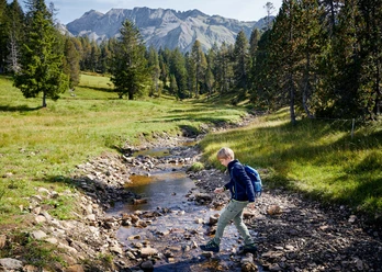
The colorful circular route delights with butterflies, dragonflies and pretty flowers, including many orchids. In the blueberry raised bog forest, you feel as if you have stepped into another world when surrounded by gnarled mountain pines. The circular hike, starting at the mountain station of the Rossweid gondola lift, lets you discover the rarities of this special habitat. For example, the carnivorous sundew, on whose sticky “feelers” insects get stuck and provide it with the nitrogen that is missing in the raised bog. Feel free to take off your shoes and you will notice how the moor soil feels with bare feet.
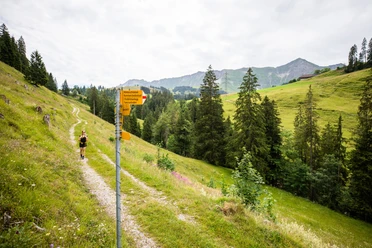
The path first leads over the sundew trail, a themed path with 17 experience stations about the moorland, up to Schwarzenegg. From there, it goes across open terrain behind the Hundschnubel (mainly known as a steep ski slope in winter) towards Blattenegg and Blattenschwand. Afterwards, there is again a beautiful section within the charming moorland near Turmschwand. Following the hiking trail towards Husegg and Salwiden, you reach the starting point Rossweid again.

Waypoints
Good to know
Best to visit
Directions
Rossweid - Schwarzenegghütte - Blattenegg - Blattenschwand - Turmschwand - Husegg - Alp Salwide - Rossweid
Tour information
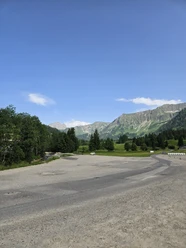
Loop Road
Mountain Railway Tour
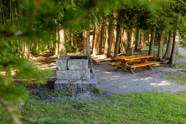
Stop at an Inn
Equipment
Good footwear, rain jacket & sufficient drinking water for the hike belong to every hike.
Further tips for safe hiking, information on suckler cow herds and livestock guardian dogs, and much more can be found on the website of the Swiss Hiking Trails.
Directions & Parking facilities
The UNESCO Biosphere Entlebuch lies in the heart of Switzerland, centrally located between Bern and Lucerne. You can reach Sörenberg via main road 10 towards Schüpfheim and from there to Flühli Sörenberg. From Giswil via the panoramic road / Glaubenbielen Pass to Sörenberg.
Plan your route using the Google route planner.
A paid parking lot is available at the valley station of the Rossweid gondola lift.
You can reach Sörenberg by public transport via Schüpfheim (Bern-Lucerne train line). From Schüpfheim, take the post bus to Sörenberg "Post".
Plan your trip with the SBB online timetable.
Additional information
Sörenberg Flühli Tourism
Rothornstrasse 21
CH-6174 Sörenberg
Tel. +41 41 488 11 85
www.soerenberg.ch
Author
UNESCO Biosphäre Entlebuch
Organization
UNESCO Biosphäre Entlebuch
License (master data)
UNESCO Biosphäre Entlebuch

Author´s Tip / Recommendation of the author
At the end, ride back down to the valley with the Trottis!
Safety guidelines
There is a suckler cow herd in the Salwideli area. Stay calm, do not startle or frighten the animals.
Map
Official map of the Swiss hiking trails 1:33,333 “Napf-Sörenberg”, ISBN number 978-3-302-33321-2
The brochure “Hiking” with many interesting hiking suggestions is available at Sörenberg Flühli Tourism or in the brochure shop at www.soerenberg.ch
Nearby


Download GPX file