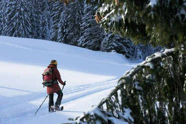
Snowshoe trail on the First near Heiligkreuz


- 1:15 h
- 3.01 km
- 122 m
- 121 m
- 1,352 m
- 1,465 m
- 113 m
- Start: Mountain restaurant First
- Destination: Mountain restaurant First
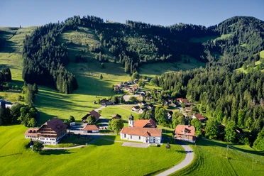
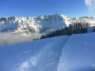
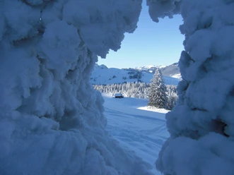
Heiligkreuz is a real gem in the UNESCO Biosphere Entlebuch. The snowshoe trail starts in the well-known pilgrimage site. Past the Kurhaus and the former holiday home of the Ingenbohler Sisters, it climbs upwards, partly following the winter hiking path in the second half. Passing the Alphütte First, it goes over snowy meadows mostly in open terrain along the panorama of Schafmatt towards Hasler Howald. Then you climb gently uphill to Doppleschwanderhowald. Unexpected here: the distant view towards Sörenberg and the Bernese Alps, which opens on good weather. Along with Schrattenfluh and Brienzer Rothorn, the trio Eiger, Mönch and Jungfrau and other Bernese high Alps are also visible.
Still enough strength in your legs? Then in safe conditions a detour to the Farnere, the local mountain of the Entlebuch main town Schüpfheim, is worthwhile. The described snowshoe trail First leads directly and relatively flat from Doppleschwanderhowald back to Bergrestaurant First. Once there, an extensive break is worthwhile: on the sun terrace you can enjoy the panorama with a real Entlebucher coffee with Träsch or Chrüter (fruit or herbal schnapps). On one side the Heiligkreuz ski lift is visible, behind it the view towards Napf and even to the Jura range. On the other side it gets more alpine: impressively, Risetenstock, Schimbrig and Schafmatt tower upwards.
After the break with the view you follow the path back to Alphütte First and on the same trail as at the beginning back to the starting point Heiligkreuz. If you don’t want to take the same way back, turn off at the mountain restaurant directly towards Reistegg and return to Heiligkreuz via the winter hiking route.
Waypoints
Good to know
Pavements
Best to visit
Directions
Mountain restaurant First - Doppleschwander Howald - Hasler Howald - Alphütte First - Mountain restaurant First
Tour information
Loop Road
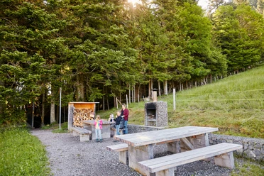
Stop at an Inn
Equipment
Snowshoes and poles as well as good, stable, water- and cold-resistant shoes.
Directions & Parking facilities
The UNESCO Biosphere Entlebuch lies in the heart of Switzerland, centrally located between Bern and Lucerne. You can reach Heiligkreuz via main road 10 from Hasle or Schüpfheim.
Plan your route with the help of the Google route planner.
You can reach Heiligkreuz by public transport via Schüpfheim (Bern-Lucerne train line). From Schüpfheim you take the PostBus to Heiligkreuz.
Plan your trip with the SBB online timetable.
Additional information
UNESCO Biosphere Entlebuch
Biosphere centre
Chlosterbüel 28
CH-6170 Schüpfheim
Tel. +41 (0)41 485 88 50
www.biosphaere.ch
Author
UNESCO Biosphäre Entlebuch
Organization
UNESCO Biosphäre Entlebuch
License (master data)
UNESCO Biosphäre Entlebuch

Safety guidelines
We ask you to observe the following points on the snowshoe trails:
- Stay on the marked routes
- Plan enough time and monitor the weather
- Behave quietly, so there is even the possibility to see wildlife; observe the animals from a respectful distance
- Your dogs may also do winter sports with us, but must be kept on a leash
- Take your trash home with you along with your beautiful memories.
If nature sports enthusiasts respect the space of the wildlife, fewer prohibitions and restrictions are needed and the natural landscape remains open for genuine nature experiences. We ask you for careful consideration and thank you for it!
Nearby

Download GPX file