Tell Trail Stage 8: Lungern - Brienzer Rothorn - Sörenberg


- 5:30 h
- 21.22 km
- 1,998 m
- 1,234 m
- 690 m
- 2,328 m
- 1,638 m
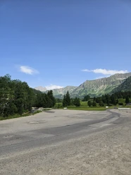
- Start: Lungern station
- Destination: Sörenberg, post office
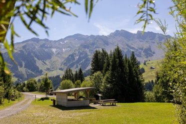
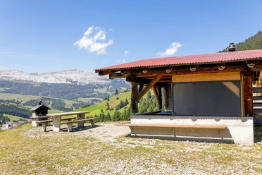
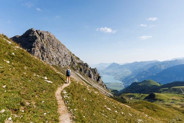
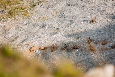
The start of the hike is the village of Lungern at the emerald-green Lake Lungern. After a short walk you reach the valley station of the Lungern-Turren cable car and comfortably float up to Turren. From here you hike via Rückenegg and Zwischenegg over the Eisee saddle to the Brienzer Rothorn. A 360° panorama unfolds on the highest mountain in Lucerne; over 690 peaks are visible in good weather, and with some luck you can also catch a glimpse of the large ibex colony. Added to this is the turquoise-blue Lake Brienz and the view into the UNESCO Biosphere Entlebuch – simply fantastic. Once the camera is packed away again, the newly renovated summit restaurant Rothorn offers fine local menus to recharge your batteries for the second part and the descent. Along the ridge and with a magnificent view, the path leads to Lättgässli. Here you descend steeply for a short time on a concrete staircase and then continue again in open terrain towards Blattenegg. From here, the landscape changes to alpine pastures and moorlands – these are particularly numerous in Entlebuch. Bogs are among the rarest and most valuable habitats in Switzerland. The UNESCO Biosphere Entlebuch includes a total of 46 raised and transitional bogs as well as 68 flat bogs of national importance with an area of about 26 km². Once you arrive at the mountain station of the Rossweid gondola, the destination is reached. A comfortable gondola ride back down to the valley at Sörenberg completes the eighth and last stage of the Tell Trail.
INFORMATION: From July 6, 2024, the Sörenberg-Brienzerhorn cable car will be back in operation. From this point, the Tell Trail stage 8 can be shortened from the Brienzer Rothorn by cable car.
Walking time: approx. 5.5 hours | Hiking distance approx. 15 km (without cable cars) | ascent 1,170 m (with cable cars 1,992 m) | descent 480 m (with cable cars: 1,530 m)

Good to know
Pavements
Best to visit
Directions
The start of the hike is the village of Lungern at the emerald-green Lake Lungern. After a short walk you reach the valley station of the Lungern-Turren cable car and comfortably float up to Turren. From here you hike via Rückenegg and Zwischenegg over the Eisee saddle to the Brienzer Rothorn. An impressive panorama of the Bernese Oberland and the turquoise Lake Brienz unfolds before you here. The path continues along the ridge to Lättgässli. From here, it descends a few altitude meters over Blattenegg to Rossweid. Finally, the cable car ride to Sörenberg completes the hike and thus the eighth stage of the Tell Trail.
Tour information
Mountain Railway Tour
Stop at an Inn
Summit
Equipment
Good hiking shoes.
Directions & Parking facilities
If stage 8 of the Tell Trail is done as a day stage:
Take the train to Lungern station or the bus to Lungern, village chapel
Additional information
This stage is part of the long-distance hiking trail Tell Trail, which runs through the whole Central Switzerland in eight stages.
More information about the Tell Trail at www.luzern.com/telltrail
Organization
Lucerne Tourisme
License (master data)
Lucerne Tourisme

Safety guidelines
T3 demanding mountain hiking.
- Good surefootedness
- Average orientation skills
- Basic alpine experience
Nearby


