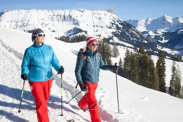
Winter hike Marbachegg-Marbach


- 2:20 h
- 9.39 km
- 35 m
- 604 m
- 866 m
- 1,471 m
- 605 m
- Start: Marbachegg
- Destination: Marbach
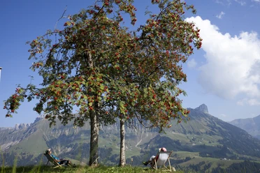
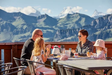
The first altitude meters on this winter hike are covered by the Bretzeli-Bahn from Marbach to Marbachegg. Once at the top, a special view awaits you – between Schibegütsch and Hohgant opens the view to the Bernese Alps with Schreckhorn, Finsteraarhorn and Eiger. Take a moment to sit in the deck chair on the sun terrace of the mountain inn and treat yourself to some refreshment before the upcoming route.
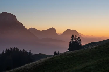
In the first section, you walk between the charming holiday cottages before the winter hiking trail turns sharply left towards Speichersee and Schottenhof Lochsitli. At the Oberlochsitli farm, the winter hiking trail continues to Wittenfärren. On this section, the impressive Schrattenfluh with the steep flanks constantly accompanies you. You also always have the Schibegütsch, which forms the southern end of the Schrattenfluh, in view. The hike shortly after the Wittenfärren farm goes into the forest and steadily downhill along the road towards Nesselboden and Cholweid. Just before the first housing area "Bühl" you can make a short detour to the Lourdes Grotto. A very special place of power. Then a cozy path leads into the village and back to the valley station of the Marbachegg ski lifts.
Special fares for pedestrians
During the entire winter season, pedestrians can ride the gondola to Marbachegg and back for only 11 francs. More information.
Waypoints

Good to know
Pavements
Best to visit
Directions
Tour information
Mountain Railway Tour
Stop at an Inn
Equipment
Good, stable, water- and cold-resistant shoes as well as poles for the necessary stability in the snow are recommended.
Directions & Parking facilities
The UNESCO Entlebuch Biosphere lies in the heart of Switzerland, centrally located between Bern and Lucerne. You can reach Marbach via main road 10 towards Wiggen (Escholzmatt). In Wiggen, turn towards Marbach. From Thun, drive via the Schallenberg to Marbach.
Plan your route using the Google route planner.
You can reach Marbach by public transport via Escholzmatt (BLS Bern-Lucerne railway line). From Escholzmatt, take the post bus to Marbach "valley station".
Plan your journey with the SBB online timetable.
Additional information
Escholzmatt-Marbach Tourism
Tourist office Marbach
Dorfstrasse 61
6196 Marbach
Phone +41 (0)34 493 38 04
[email protected]
www.escholzmatt-marbach-tourismus.ch
Literature
You can download or order the winter hiking brochure - hiking suggestions in the UNESCO Biosphere Entlebuch here.
Author
Escholzmatt-Marbach Tourismus
Organization
UNESCO Biosphäre Entlebuch
License (master data)
Escholzmatt-Marbach Tourismus

Author´s Tip / Recommendation of the author
Safety guidelines
Please observe the following points on the winter hiking trails:
- Stay on the marked routes
- Plan enough time and monitor the weather
- Behave calmly; there is even the possibility to see wild animals; observe the animals from a respectful distance
- Your dogs are also allowed to do winter sports with us, but must be kept on a leash
- Take your rubbish home with your beautiful memories.
If outdoor sports participants respect the space of wild animals, there will be fewer bans and restrictions and the natural landscape remains open for genuine nature experiences. We ask you for careful consideration and thank you for it!
Nearby


