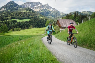
Äntlibuecher route


- 3:30 h
- 34.03 km
- 1,023 m
- 1,023 m
- 684 m
- 1,167 m
- 483 m
- Start: Entlebuch, station
- Destination: Entlebuch, station
The start is at Entlebuch station and follows the signs of bike route 813 for the entire distance. The route first follows the road to Ebnet. From there, you ride uphill through the Staldigwald and Brameggwald to Lobenalp, where it then goes downhill towards Farnbüel. The path continues through the Schachnerwald uphill and downhill towards Rotmoos and further to Finsterwald before you reach Entlebuch station again.
Connection to the Schimbrig-First route via Finsterwald-Gfellen-Stillaub-Flöschen.
Waypoints
Good to know
Best to visit
Directions
Entlebuch - Ebnet - Gmeinwerch - Alp - Bramegg - Farnbüel - Fischebachsagi - Lutersarni - Rotmoos - Wissenegg - Finsterwald - Entlebuch
The route is signposted with route fields No. 813 - Äntlibuecher route.
Tour information
Loop Road
Stop at an Inn
Equipment
Directions & Parking facilities
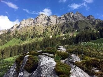
The UNESCO Biosphere Entlebuch is located in the heart of Switzerland, centrally between Bern and Lucerne. You can reach Entlebuch via main road 10.
From Sarnen you reach Entlebuch via the Glaubenberg Pass.
Plan your route using the Google route planner.
- You can reach Entlebuch by public transport via the Bern-Lucerne railway line.
Plan your trip with the SBB online timetable.
Additional information
UNESCO Biosphere Entlebuch
Biosphere Center
Chlosterbüel 28
CH-6170 Schüpfheim
Phone +41 (0)41 485 88 50
www.biosphaere.ch
Literature
You can find the brochure «Bike Guide» in the brochure shop at www.biosphaere.ch/broschueren
Author
UNESCO Biosphäre Entlebuch
Organization
UNESCO Biosphäre Entlebuch
License (master data)
UNESCO Biosphäre Entlebuch

Author´s Tip / Recommendation of the author
Safety guidelines
Wear the right protective gear, assess your skills correctly, give priority to walkers, stay on the trail and close pasture fences! Refer to the Central Switzerland Bike Code - so you will be welcome on your mountain bike!
Nearby


Download GPX file