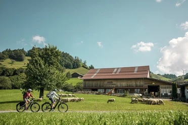
Chöhler-Route


- 1:30 h
- 16.30 km
- 848 m
- 618 m
- 765 m
- 1,065 m
- 300 m
- Start: Romoos
- Destination: Romoos
The Chöhler-Route starts at the Romoos bus stop and follows the signs of the bike route 811 throughout. It leads uphill to Schwändi and then to Finsteregg. From there it goes downhill and uphill towards Schwäntegg. At Schmitteli you meet the starting route again, which then leads back via Studen to Romoos. You pass three charcoal burner sites; maybe a kiln is being built, fired, or dismantled, with some luck you can watch the charcoal burners at work.
From the charcoal burner site Pilgereggweid you can extend the route towards Bramboden up to Schüpfheim.
Good to know
Best to visit
Directions
Romoos - Stude - Schwändi - Schwesteregg - Finsteregg - Drachslis - Pilgereggweid - Glashüttli - Grossegg - Schwäntegg - Schmitteli - Stude - Romoos
The route is signposted with route fields No. 811 - Chöhler-Route.
Tour information
Stop at an Inn
Equipment
Directions & Parking facilities
The UNESCO Biosphere Entlebuch lies in the heart of Switzerland, centrally located between Bern and Lucerne. You can reach Romoos via main road 10 and follow the traffic signs towards Doppelschwand-Romoos in Entlebuch or Wolhusen.
Plan your route with the help of the Google Route Planner.
You can reach Romoos by public transport via Wolhusen (Bern-Lucerne train line). From Wolhusen you take the PostBus to Romoos "Post".
Plan your trip with the SBB Online Timetable.
Additional information
UNESCO Biosphere Entlebuch
Biosphere Center
Chlosterbüel 28
CH-6170 Schüpfheim
Tel. +41 41 485 88 50
www.biosphaere.ch
Literature
The brochure «Bike Guide» is available in digital version via www.biosphaere.ch/broschueren
Author
UNESCO Biosphäre Entlebuch
Organization
UNESCO Biosphäre Entlebuch
License (master data)
UNESCO Biosphäre Entlebuch

Author´s Tip / Recommendation of the author
Idyllically situated on a ridge at the foot of the Napf at 1050 meters above sea level is the Schwesteregg farm with its popular Rose-Beizli, ideal for a stop and refreshment.
Safety guidelines
Attention, critical sections: Relatively steep and demanding descent from Finsteregg to Drachslis (Charrweg, used for forestry management, it is also part of the charcoal burner path Romoos to Bramboden), stream crossing before Drachslis. Short steep climb at Pulver to Grossegg (farm access road).
Wear the right protective gear, assess your skills properly, give priority to hikers, stay on the trail and close pasture fences! Refer to the Bike-Kodex Central Switzerland – that way you remain welcome on your mountain bike!
Nearby