Kleiner Susten route


- 1:30 h
- 11.15 km
- 457 m
- 457 m
- 675 m
- 1,079 m
- 404 m
- Start: Romoos
- Destination: Romoos
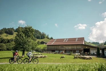
The route starts in the "Best Tourism Village" Romoos in the UNESCO Biosphere Entlebuch and follows the well-marked bike route 812. Initially, it goes on a quiet side road towards Grämse, then continues on a gravel road to the highest point of the route: Holzwäge at 1,081 m above sea level. The cozy Beizli invites you to take a break with a fantastic view.
From Farner, the descent becomes more varied again. You leave the asphalt road and follow a meadow path, which soon turns into a shady forest path with dense woods. This section is steeper and strewn with larger stones. A technical challenge that is worth it. Here a real natural spectacle is revealed. The path winds through an impressive gorge shaped by the Nagelfluh and a small waterfall.
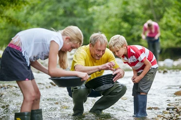
Soon after, you reach the lowest point of the route, where two streams have deeply carved into the Nagelfluh. An ideal moment for a short break and exploration of the riverbed, because Romoos is known for gold panning.
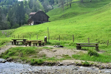
After a final ascent, the path leads back to Romoos. If you like, you can stop at the Hotel Kreuz and enjoy a genuine Entlebuch specialty and even recharge your e-bike battery.
Waypoints

Good to know
Best to visit
Directions
Romoos - Weierhüsli - Säumettle - Grämse - Holzwegen - Chienis - Ilmisberg - Farnere - Neumatt - Flüebode - Romoos
The route is marked with route fields No. 812 - Kleiner Susten route.
Tour information
Loop Road
Stop at an Inn
Equipment
Directions & Parking facilities
The UNESCO Biosphere Entlebuch is located in the heart of Switzerland, centrally between Bern and Lucerne. You can reach Romoos via main road 10 and follow the traffic signs towards Doppelschwand-Romoos in Entlebuch or Wolhusen.
Plan your route using the Google route planner.
You can reach Romoos by public transport via Wolhusen (Bern-Lucerne railway line). From Wolhusen, take the PostBus to Romoos "Post".
Plan your journey with the SBB online timetable.
Additional information
UNESCO Biosphere Entlebuch
Biosphere Center
Chlosterbüel 28
CH-6170 Schüpfheim
Tel. +41 41 485 88 50
www.biosphaere.ch
Literature
The "Bike Guide" brochure can be found in the brochure shop at www.biosphaere.ch/brochures
Author
UNESCO Biosphäre Entlebuch
Organization
UNESCO Biosphäre Entlebuch
License (master data)
UNESCO Biosphäre Entlebuch

Author´s Tip / Recommendation of the author
Safety guidelines
Attention, critical section: relatively steep and demanding descent from Farneren to Mühli (Charrweg, this section is also a hiking trail).
Wear the right protective equipment, assess your abilities correctly, yield to hikers, stay on the trail, and close pasture fences! Orient yourself with the Central Switzerland Bike Code - this way you will be welcome on your mountain bike!
Nearby

Download GPX file