Circular route Entlebuch – Rengg – Ebnet


- 3:50 h
- 12.33 km
- 394 m
- 394 m
- 611 m
- 1,006 m
- 395 m
- Start: Entlebuch train station
- Destination: Entlebuch train station
After starting through the village of Entlebuch and the first altitude meters covered, the path leads through a deep hollow way (historical cart track) with the Chessiloch sunk up to four meters deep. Also on this section, you come across the large landslide area of 2005/2006, where forest is growing again in the upper part. Upon reaching the Rengg, the most strenuous part of the route is already done and you can enjoy the beautiful panorama.
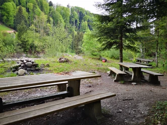
Later, there is a resting bench with a table in the middle of the forest for taking a break. At Underwald, the path skirts the moorland «Zittermoos», where a cart with horses is said to have disappeared. Shortly after, you follow a deep hollow way for about 400 meters, which was part of the old mule track between Entlebuch and Lucerne.
Through forest and meadow, the hike now leads downhill past the Lindenhof Ebnet to the Kleine Emme. Stop at Lindenhof, where in addition to an innovative restaurant you will find the production site of Entlebucher beer and Edelwhite gin. A tasting is highly recommended. Please check the opening hours in advance.
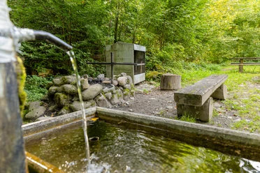
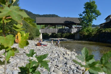
Along the Emme riverside path to Entlebuch, the immense shaping power of water in the nationally important floodplain landscape becomes apparent. On this section, you will find two generous rest areas inviting you to linger.

Waypoints
Good to know
Pavements
Best to visit
Directions
Entlebuch - Lehn - Rengg - Unterwald - Ebnet - Emmenmätteli - Entlebuch
Tour information
Cultural Interesting
Loop Road
Stop at an Inn
Equipment
Good footwear, rain jacket & adequate drinking water for the journey are essential for every hike.
More tips for safe hiking, information about suckler cow herds and guardian dogs, and much more are available on the Swiss Hiking Routes website.
Directions & Parking facilities
The UNESCO Biosphere Entlebuch lies in the heart of Switzerland, centrally located between Bern and Lucerne. You can reach Entlebuch via main road 10. From Sarnen, you reach Entlebuch via the Glaubenberg Pass.
Plan your route using the Google route planner.
A paid parking lot is available at the train station or Business Park Entlebuch.
You can reach Entlebuch by public transport via the Bern-Lucerne railway line.
Plan your journey with the SBB online timetable.
Additional information
CH-6162 Entlebuch
+41 41 79 651 64 54 (Monday to Friday between 9 and 11 a.m.)
[email protected] / www.tourismus-entlebuch.ch
Literature
You can obtain the brochure «Hiking - Hiking suggestions in the UNESCO Biosphere Entlebuch» at the Biosphere Center or in the brochure shop at www.biosphaere.ch
Author
UNESCO Biosphäre Entlebuch
Organization
UNESCO Biosphäre Entlebuch
License (master data)
UNESCO Biosphäre Entlebuch

Author´s Tip / Recommendation of the author
Visit the Lindenhof Ebnet in the final part of the route or refresh yourself after the hike at the Biosphere gastro partners, the Landgasthof Drei Könige or Bahnhöfli Entlebuch.
Nearby


Download GPX file