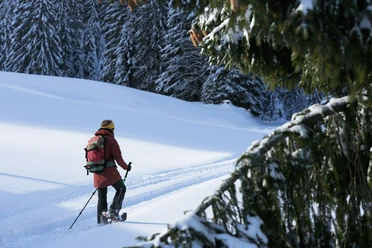
Snowshoe trail Hirsegg - Chlus


- 5:00 h
- 10.65 km
- 717 m
- 717 m
- 1,070 m
- 1,787 m
- 717 m
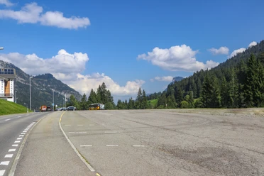
- Start: Sörenberg, bus stop Hirsegg
- Destination: Sörenberg, bus stop Hirsegg
The well-marked snowshoe trail leads from Hirsegg first up to Alp Schlund. On the left towers the snow-covered Brienzer Rothorn, the highest mountain in Lucerne, and always in sight is the distinctive Schrattenfluh. In addition to the numerous and beautiful pre-alpine moor landscapes, the biosphere reserve is also recognized by UNESCO for its unique karst areas. The Schrattenfluh, the most obvious karst mountain in the Entlebuch biosphere, is part of the strictly protected core zone and one of the most natural karst landscapes in Switzerland.
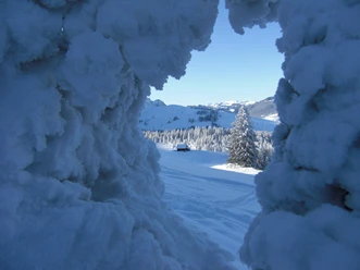
If the flag is raised at the Alp Schlund, there is something to drink – on beautiful winter days the alpine hut is open and the Entlebuch Kafi schnapps wonderfully warms on cold winter days. After Schlund, the path goes through a beautiful forest section with gnarled mountain pines and spruces. Again and again, you catch a glimpse of the Giswilerstock, the Brienzer Rothorn chain or the "Böli", a rock ridge on the Schrattenfluh and more or less also the destination of the snowshoe tour. The route continues moderately uphill, the forest thins out again, and further rock ridges of the Schrattenfluh appear, especially the Schibengütsch, which is soon clearly visible to the right of the Böli. Past the Böli, the destination is reached very soon, hidden just on the other side is the Chlus hut. The view from the Chlus is simply indescribable: the Brienzer Rothorn chain and the Bernese high Alps present themselves as if on a silver platter. Eiger, Mönch and Jungfrau, Schreck- and Finsteraarhorn – to name just a few of the mighty Alpine peaks. The long ascent has more than paid off – every drop of sweat, every heavy breath is rewarded with this panoramic view.
After resting or spending the night in the Chlus hut, the snowshoe trail leads back on the same path to Hirsegg. But don't worry, the view makes you forget that it's the same path. On the way back, you look out over the extensive mountain world with Giswilerstock, Nünalpstock, Haglere up to Fürstei and Schwändelifluh. Thanks to the different habitats, the Schrattenfluh has a great variety of wildlife and also special and endangered species. Therefore, the routes should under no circumstances be left, so as not to disturb the peace of the wild animals. In addition, the Schrattenfluh has, besides sharp limestone rocks, deep caves and fissures, which are not visible in winter under a cover of snow. On the marked trail you safely return to the starting point.
Good to know
Pavements
Best to visit
Directions
Hirsegg - Schlund - Alp Chlus - Schlund - Hirsegg
Equipment
Snowshoe rentals
Stöckli Swiss Sports AG
Rothorn-Center 2
6174 Sörenberg
Tel. +41 (0)41 488 17 76
www.stoeckli.ch
Felder Sport
Rothornstrasse 14
6174 Sörenberg
Tel. +41 (0)41 488 12 49
www.feldersport.ch
perDU Shop
Rothorn-Center 3
6174 Sörenberg
Tel. +41 (0)41 488 18 88
www.perdu-soerenberg.ch
Directions & Parking facilities
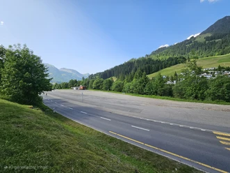
The UNESCO Biosphere Entlebuch is located in the heart of Switzerland, centrally between Bern and Lucerne. You can reach Sörenberg via main road 10 towards Schüpfheim and from there towards Flühli Sörenberg. Hirsegg is just before the village of Sörenberg; you can park at the Hirsegg bus stop.
Attention, the Glaubenbielen Pass (Sörenberg - Giswil) is closed in winter!
Plan your route using the Google route planner.
You can reach Sörenberg by public transport via Schüpfheim (Bern-Lucerne railway line). From Schüpfheim, take the post bus to Sörenberg "Hirsegg".
Plan your journey with the SBB Online Timetable.
Additional information
Rothornstrasse 21
CH-6174 Sörenberg
Phone +41 (0)41 488 11 85
[email protected]
www.soerenberg.ch
Author
Sörenberg Flühli Tourismus
Organization
UNESCO Biosphäre Entlebuch
License (master data)
Sörenberg Flühli Tourismus

Author´s Tip / Recommendation of the author
Take provisions with you on the route! At the SAC hut Chlus there are tables & benches with great views of the mountain scenery! The Volg in Sörenberg offers a great selection of local products from meat to cheese, bread and even strawberry wine from the local producer.
Safety guidelines
Please observe the following points on the winter hiking trails:
- Stay on the marked routes
- Allow enough time and monitor the weather
- Behave quietly, so there is even the chance to see wildlife; observe the animals from a respectful distance
- Your dogs are also allowed to practise winter sports here, but must be on a leash
- Take your rubbish home with your wonderful memories.
When nature sports enthusiasts respect the space of wild animals, fewer bans and restrictions are needed and the natural landscape remains open for genuine nature experiences. We kindly ask for your careful consideration and thank you for it!
Map
SVS snowshoe map 1:25,000 Sörenberg/Flühli
The map is available from Sörenberg Flühli Tourism for CHF 3.00.
Nearby