Marbacher Panoramarunde


- 3:30 h
- 22.09 km
- 952 m
- 952 m
- 830 m
- 1,527 m
- 697 m
- Start: Marbach
- Destination: Marbach
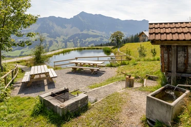
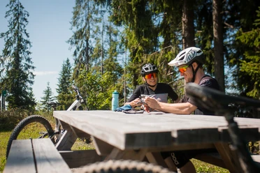
The Marbacher Panoramarunde starts in the village of Marbach and follows the signs of bike route 820 along the entire route. First, you ride along the road into the Hilfern Valley, where you enjoy a unique view of the Schrattenfluh. From there, it goes uphill to the Hürndlihütte and then back down through the Marbach Gorge. The route leads uphill and downhill to Marbachegg, passing Alp Imbrig, where fine alpine cheese is made.
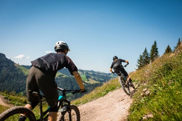
From Marbachegg, the route leads back to the valley station and to the village of Marbach via the Clientis Flowtrail Marbachegg. The 4 km varied route is equipped with many playful elements. Bikers from small to large, young or old, are equally enthusiastic about the diverse challenges over roots and stones. Difficult sections are marked and can be bypassed.
As an alternative to the Clientis Flowtrail Marbachegg (red trail), there is a bypass for leisurely mountain bikers. Via Kadhusspycher (just before Marbachegg) follow the road towards Nesselboden - Risete back to Marbach.
Connection to the Rund um die Schrattenfluh route is possible via Ober Lochsitli.
Waypoints

Good to know
Best to visit
Directions
Marbach - Geissemoos - Hilferetal - Buhütte - Hürndliegg - Steiwang - Imbrig - Chadhus - Marbachegg - via the Clientis Flowtrail back to Marbach
The route is signposted with route markers No. 820 - Marbacher Panoramarunde.
Tour information
Loop Road
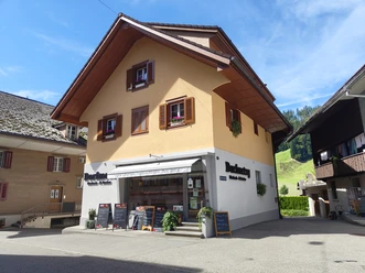
Stop at an Inn
Equipment
Wear the right protective gear, assess your skills correctly, give way to hikers, stay on the trail and close grazing fences! Follow the Central Switzerland Bike Code – that way you will be welcome on your mountain bike!
Directions & Parking facilities
The UNESCO Entlebuch Biosphere lies in the heart of Switzerland, centrally located between Bern and Lucerne. You can reach Marbach via main road 10 towards Escholzmatt - Wiggen and from there to Marbach. From Thun, you can get to Marbach via the Schallenberg Pass.
Plan your route using the Google route planner.
You can reach Marbach by public transport via Escholzmatt (Bern-Lucerne railway line). From Schüpfheim, take the post bus to Marbach "valley station".
Plan your trip with the SBB online timetable.
Additional information
UNESCO Entlebuch Biosphere
Biosphere Center
Chlosterbüel 28
CH-6170 Schüpfheim
Phone +41 (0)41 485 88 50
www.biosphaere.ch
Literature
The brochure "Bike Guide" can be found in digital format via www.biosphaere.ch/broschueren
Author
Escholzmatt-Marbach Tourismus
Organization
UNESCO Biosphäre Entlebuch
License (master data)
Escholzmatt-Marbach Tourismus

Author´s Tip / Recommendation of the author
Safety guidelines
The route can only be ridden in the signposted direction.
Warning, critical section:
- Steep passage between Steiwang and Imbrig.
Nearby

Download GPX file